Water Safety Approach in the Netherlands
- 22 December 2021
- Francien Horrevorts
- Emergency Response
As the Netherlands is for the most part below sea level, water management and protection of the land has always been an important matter for the Dutch. So what is the water safety approach in the Netherlands? An interesting topic for Bart Vonk of Rijkswaterstaat to address during the latest partner meeting. Read the summary in this article or watch his full presentation.
Bart Vonk
Bart Vonk, Senior Advisor Water Safety at Rijkswaterstaat, sets out what the water safety approach of the Netherlands entails. Rijkswaterstaat is the executive agency of the Ministry of Infrastructure and the Environment dedicated to promoting safety, mobility and the quality of life in the Netherlands. They collaborate with other public authorities responsible for water management to protect the Netherlands against flooding.
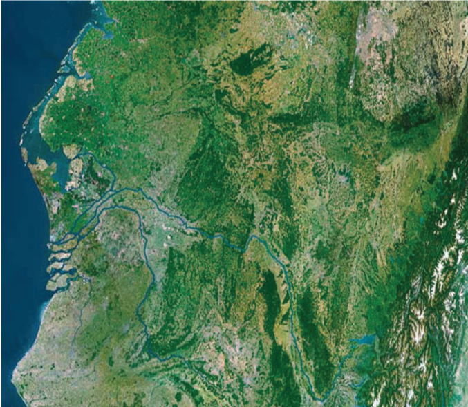
The Netherlands is a delta
The Netherlands is the delta of several rivers that end in the North Sea in the Netherlands; the Rhine, Meuse, Scheldt and Eems. The Netherlands has a rich history dealing with the water levels. Land reclamation, levees and drainage created the country as it is today. Some figures about the Netherlands sum up this history. The country has around 350 kilometres of coastline and 3500 km of flood defences, hundreds of locks, sluices and pumping stations. About 9 million inhabitants live below flood level. The Netherlands invests around 0.2-0.3% of the GDP in flood defence, which protects around €1800 bn benefit to the economy. Due to sound governance, the Netherlands is a safe place to live. The basic level of protection by the flood defence system is that the probability of one person dying because of flooding may not exceed once in 100.000 years (1:100.000). The chances to evacuate people on one hand or group risks, the economic value, social disturbances or vital power plants on the other hand can lead to higher or lower protection levels.
Future challenges
Currently, the delta is under pressure because of several future developments like climate change, spatial demands, population and economic growth etc. Due to climate change, the weather conditions are changing dramatically. More extreme storms and intense rainfall are occurring and expected to further increase in numbers. Moreover, the problem is that the sea level is rising (slowly) and the land is subsiding (fast). In the next 100 years, the sea level is expected to rise 35 to 85 cm and the land to subside 10 cm. Furthermore, spatial development expands which leaves less room for water and erosion is increasing which causes salt intrusion in the hinterland. This causes serious threats to farming and the supply of drinking water. Conclusion: if we do not act, the Netherlands will encounter several serious water related problems, one of which is the flooding of densely populated parts of the country.
How to manage water related threats
How do the Netherlands manage these water related threats? The governance is made up of several elements:
- a long-term strategy by the Delta commissioner
- an excellent river and canal system, which gives room to the river
- strong and reliable flood defences
- safety levels are mandatory, covered in a legal framework in the Dutch water act. Some of the elements in this framework are: legal assessment every 12 years, Dutch Flood Protection Program (340 million euro a year), Duty to care (zorgplicht) yearly safety report and trained crisis management teams.
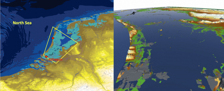
Key to a successful adaptation are the following issues that the Delta Commissioner focuses on: flood protection standards, strategy of fresh water supply, water level management of the IJsselmeer, protection strategy of the Rotterdam area and a new framework for spatial planning urban areas.
Classification defence system
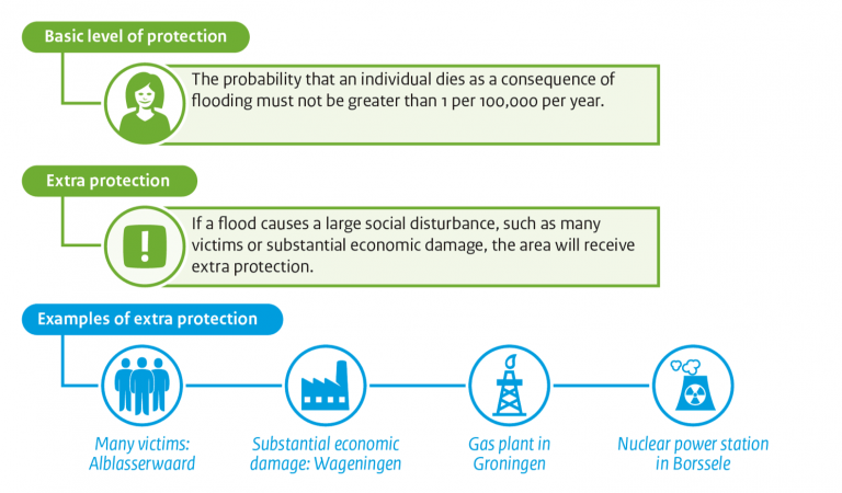
Another important element for water management in the Netherlands is the classification of the water defence system. There are two levels of protection:
- Basic level of protection: the probability that an individual dies as a consequence of flooding must not be greater than one per 100.000 a year, comparable with safety levels in the aviation branch.
- Extra level of protection: if a flood causes a large social disturbance, such as many victims or substantial economic damage, the area will receive extra protection.
Examples of extra protection are:
- Alblasserwaard area, due to chances of many victims
- Wageningen area, due to substantial economic damage
- Groningen area, due to gas plant
- Borssele area, due to nuclear power station
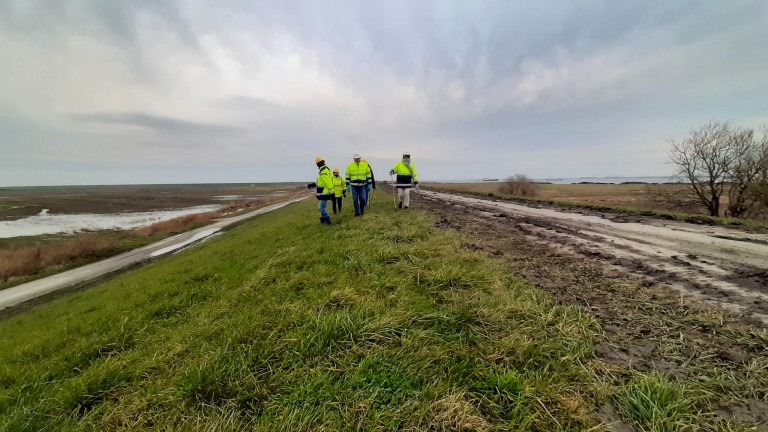
Levee assessment
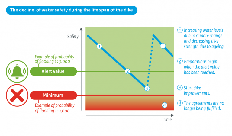
During the lifespan of the levee the safety declines. Climate change can lead to higher hydraulic loads in the future and also we gain new insights in failure mechanisms. Therefore, levee assessment is an important aspect of the activities of Rijkswaterstaat. It is part of continuously improving flood protection in the Netherlands. Due to the water act, Rijkswaterstaat and all regional water authorities have the duty to take care of its flood defences. The levees are evaluated every 12 years based on statutory assessment instruments made available by the minister. On the basis of these assessments, the flood protection programme is set up and executed. See the figure below showing the relation between the levee safety and time and how the levee improvements are connected. As the alert value of the probability of flooding is three times stricter than the minimum value, improvements are started in time, before the levee safety value drops to an unacceptable low point. This water safety programme of the Dutch government aims to minimise the risk of flooding and potential victims and to ensure a safe living environment.
Watch full presentation
For more detailed information on this topic, watch the full presentation.
Read more
Curious to learn more about Rijkswaterstaat and what they do? Read the interview with Bart Vonk about Rijkswaterstaat and their role in Polder2C’s and more.